
Introduction
The line of the boundary between the railway line (Network Rail’s property) and Moray Place has been an issue of debate for some time, most notably when Network Rail began clearing vegetation from the line in 2004-05.

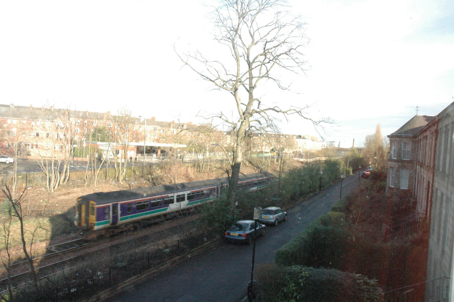
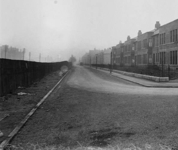
18-25 Moray Place 2004
Same view, 2005 after vegetation management. The one remaining tree was removed shortly after.
More recently they proposed further vegetation clearance to renew the boundary fence in January 2015. They planned to remove the metal hooped fence and replace it with a 1.8m high weldmesh fence in the same location. However residents suspected the hooped fence was not on Network Rail’s land.
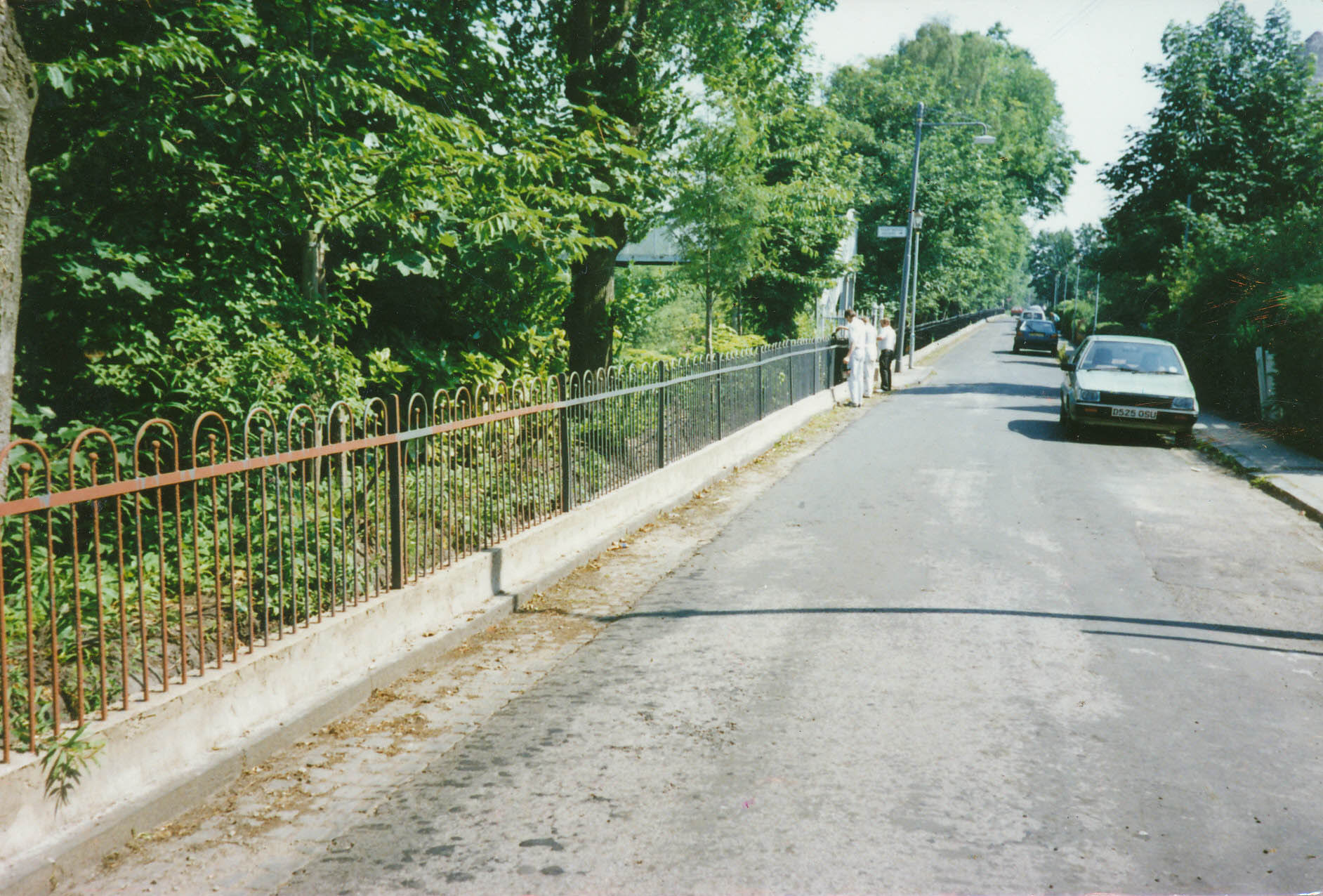
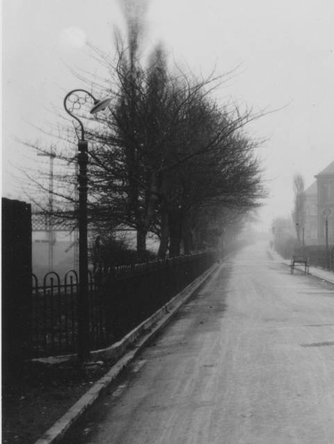
Railings after fence and concrete repair and painting, circa 1990
Negotiations led by the Strathbungo Society centered on two points; firstly the need for a more appropriate fence design, and secondly that it needed to be on their land, further back than the existing fence. Eventually Network Rail conceded, leading to the new fence design erected in February 2017. The following is the historical research that led to their concession regarding the position of the fence. It is recorded here for posterity.
The Land Register
Title is currently defined by a map kept in the Land Registry, for any purchase made since 1981. This title map is an extract of an OS Map, with the subject of the title outlined, often in red. An example is shown below.
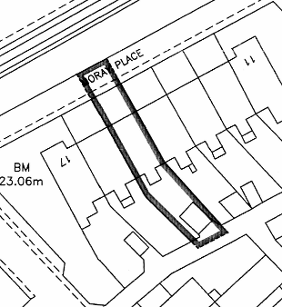
Sample land registry entry
Network Rail used these maps to argue the fence was on their land. The map is the Keeper’s one off interpretation of the original deeds, but is not thought legally binding, as it is only representative of the deeds. The deeds, however, were often destroyed once the entry had been made. Experience suggests these title maps are inconsistent, and have often just been drawn to the edge of the road on the modern map, as in this example, suggesting the hooped metal fence is the boundary, and leaving it unclear who owns it. Review of the collective title maps provided by Network Rail supported this; every one was different, despite every property being derived from a single land purchase and deed.
It is likely the railway itself is not entered in the Land Registry as it has not changed hands since it was built.
The Evidence
Several residents provided Land Registry Title maps for properties on Moray Place. Some use the current fence as the boundary (e.g. 15, 23 & 30 Moray Place), others extend just beyond it (e.g. 22 Moray Place). These maps are therefore inconsistent.
So can we define the original boundary? Well, yes, from old documents, we can.
The railway line opened in 1848, before any building in Strathbungo.
A proposed but unexecuted feuing map from 1859 for the land now known as Strathbungo clearly shows the stone wall boundary to the line, extending from the road bridge at Nithsdale Road to approximately where Marywood Square is now, with a hedge extending along the remainder of the boundary.
Unexecuted feuing plan 1859; wall (red) and hedge (green).
The original feu disposition between Sir John Maxwell and the developer William Stevenson and others in 1860 for the building of what we now consider Strathbungo defines the boundary as “…on the north west by north by the property of the Glasgow Barrhead and Neilston direct Railway Company along which it extends one thousand seven hundred and seventy one feet or thereby on a line parallel to and situated at the distance of three feet southeast by southward from the centre of the present thorn hedge and from the southeast by south face of the present stonewall …” Thus the boundary is three feet on the South East, residential, side of the original stone wall or hedge.
The original deeds and plan for No 13 confirm the boundary as three feet from the wall. The current title of 22 Moray Place includes a note referencing the three feet distance, but in the absence of the original deeds the note makes no sense in relation to the Land Registry title map.
The wall still exists from 1 to 6 Moray Place.
The feu to the builder of 18-25 Moray Place in 1874 states the building line must be 46 feet from the boundary to ensure the building 18-25 Moray Place is exactly in line with the previous two terraces, 1-10 and 11-17. It was built thus, and so the boundary can be calculated back 46 feet from the building.
A further map prepared by the railway company c. 1875 to acquire additional land on the other side of the line for the construction of Strathbungo Station again shows the stone wall, but also the first three terraces along Moray Place, thus allowing us to measure the distance from the building line to the stone wall to within a foot or so, and this measures approximately 50 feet. Thus the boundary would be 3 feet from the wall, and so 47 feet from the building line. This is in reasonable agreement with the 46 feet calculated above.
The stone wall no longer exists from 7 Moray Place onwards, and has been replaced by a hooped metal fence, erected probably 1870-1890. This was perhaps when Strathbungo Station was built, the station opening in 1877, and the platforms extending as far as Marywood Square.

The proposal for Strathbungo Station, 1875, again shows the wall, 49-50ft from the building line of the houses on Moray Place. The original boundary was 46ft from the building line, and the current hooped fence is 45ft from the building line, and so on residents’ property.
The distance from the hooped metal fence to the face of the buildings was estimated by laser measure in March 2015 at seven different points along Moray Place, and it is on average 45 feet from the building line, placing the boundary one foot on the railway side of the metal fence, and implying the original stone wall was some 4 feet further back on the embankment than the hooped metal fence.
Thus the hooped metal fence is on residents’ property, their boundary extending 1 foot the other side of it.
The Gardens
When the houses were built between Vennard and Carswell Gardens, in 1927, the feu disposition defines the properties as three feet southeast by south of a sleeper fence erected along the railway. While the position of the fence is not defined, it presumably lies along the line of the original hedge, as this land was included in the original feu disposition of Sir John Maxwell to William Stevenson in 1860, and that boundary would still apply when the land was feued by William Stevenson’s trustees to the builder.
The sleeper fence is clearly visible in contemporary photographs c. 1930, some 5 feet from the kerb. The sleeper fence appears to correspond fairly accurately to the more modern post and wire fence, which replaced it in the 1960s or 1970s. Thus the boundary along this section likely lies three feet to the South East, residential side, of the current fence.
Moray Place c 1930 showing sleeper fence
End of sleeper fence, start of hooped railings. c 1930
Network Rail view
In correspondence, Network Rail officials initially claimed the land to the metal hooped fence, and the fence itself, as their own. They based their claim on a supplied copy of the Disposition of land to the Glasgow & Barrhead Direct Railway Company of 1858, but this has insufficient detail to determine any boundary accurately, as there is no detailed description and only a small scale map with no geographical features. One thing to note from the 1858 Disposition is the comment on the small scale maps that the boundary at a number of points extends three feet beyond the boundary feature (railings, etc). While this is not mentioned on the Strathbungo section, it would appear to confirm the three feet beyond the original wall & hedge does belong to Network Rail, and that it was standard practice of the Barrhead & Neilston Direct Railway Company to erect their boundary markers three feet inside their land boundary. Indeed later Network Rail conceded this remains normal practice; they now normally place fences 1 metre inside their boundary.
Conclusion
The original boundary was three feet South East of the railway boundary wall and hedge.
While only a short section of wall remains, the line of the boundary can be clearly seen on old plans, and determined from measurements included in the original feu documents.
The boundary is 3 feet from the stone wall at 1-6 Moray Place, and thus 47 feet from the building line there, by laser measure. The boundary is likely the same for 7-10, and thus at the wooden fence, which is 47 feet from the building line.
Beyond the footbridge at Regent Park Square, a more recent metal hooped fence ran to Vennard Gardens, replacing the original stone wall, but closer to the buildings by 4 feet. This lay 45 feet from the building line, and therefore 1 or 2 feet inside the residents’ boundary, which is stated in the feu documents as 46 feet from the building line.
Beyond Vennard Gardens, the wire and post fence likely followed the line of the previous sleeper fence, and the hedge before it, and thus the boundary lies 3 feet South East of the post and wire fence.
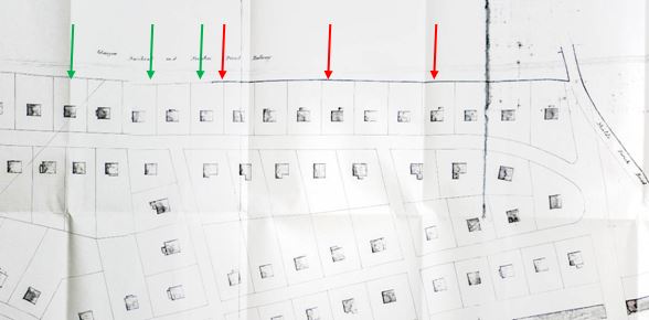
The following illustrates the pre 2017 fences, and the line of the proposed replacement.
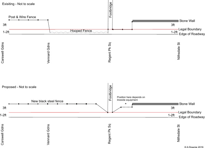
Railway boundaries, proposed changes
2017 Update
The replacement fence is now in (March 2017), and set well back from the road edge. The depth varies, but in some places it is even further back than the original fence line. This is well illustrated below, where during vegetation clearance, the remains of the old sleeper fence has emerged from beneath the shrubbery, and the new fence is even further behind it.

The new railway fence, March 2017. Note the stumps of the old sleeper fence in the centreground.
Leave a Reply