Biographies of most of the major players in the building of Strathbungo including land owners, builders and architects.

Search results: "BRICK" (page 5 of 6)
A shift of direction
As noted previously, Strathbungo changed radically from 1860 onwards, as the rural village gradually vanished beneath urban expansion. Not only did the buildings vanish, but the location of Strathbungo shifted too. Although Strathbungo was then outside Glasgow, the Corporation of Glasgow had purchased Pathhead Farm for the purposes of creating a major public park (Queens Park), which was laid out from 1857 to 1862. Land in the vicinity of the park became valuable for speculative building. This was particularly so in Crosshill immediately to the north of the park, an area previously farmland with few dwellings. As it grew it became a self-governing police burgh in 1871, its western boundary extending roughly to Niddrie Square. Govanhill followed suit as a police burgh in 1877, and the Gorbals, annexed to Glasgow in 1846, already reached Strathbungo’s northern border at the parish church.
Strathbungo had no special status of its own, just a small village in a small corner of Renfrewshire, and the neighbouring communities were already encroaching on it when Glasgow expanded massively in 1891, annexing large parts of the southside including Bellahouston, Crossmyloof, Langside, Mount Florida, Polmadie, Shawlands and Strathbungo. This may explain why the village of Strathbungo rather lost its identity. I believe even now it has no legal status, except as part of Shawlands and Strathbungo Community Council.

The village of Strathbungo was a small rural hamlet consisting of coal miners, weavers, flower growers, and a number of public houses, up until the major urban expansion of Glasgow and its suburbs circa 1850-60.
The village in the early 19th Century
The best accounts of early Strathbungo are probably found in Alexander Scott’s articles for the Archaeologcal Society of Glasgow, Notes on the Village of Strathbungo , and An Account of the Kinninghouse Burn . Although written in the 1880s, he spoke to many elderly locals to produce an account of the village in earlier times.
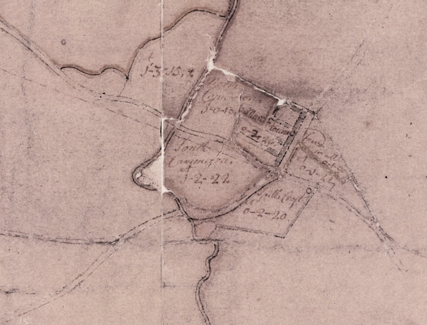
Map of Pollok Estate excerpt. Robert Ogilvy. 1741
Robert Ogilvy’s map of 1741 is the first detailed record of the village. It shows buildings all along the west side of the main road to Pollokshaws, from the boundary with the Gorbals in the north down to the Crosshill Burn in the south, named as Marchtoun. Plots of land include North Cammeron, north of the present Nithsdale Street, and two smaller plots behind it across the Kinninghouse Burn. South Cammeron is to the south of Nithsdale Street, west of Pollokshaws Road, and bounded by the two burns west and south.
Continue reading
© 2024 Bygone Bungo
Theme by Anders Norén — Up ↑
Recent Comments