
George Washington Wilson
This photograph of Strathbungo was taken by George Washington Wilson (1823-1893), a pioneering Scottish landscape photographer. After his studies in Edinburgh and London he returned to his natmaive Aberdeen and began work as a painter of portrait miniatures.

George Washington Wilson, self portrait.
Moving on to the relatively new concept of portrait photography in 1852, he achieved success photographing Queen Victoria at Balmoral. He then moved on to landscape photography, and amassed a huge collection of photographic glass plates of scenes of Scotland, the United Kingdom and the world. By 1864 he claimed to have sold over half a million prints, and was by then one of the world’s most successful photographers .
In 1954 38,000 of his plates were saved from a cellar and presented to Aberdeen University , and the full collection is now available on line on the University website, making a fascinating resource for those interested in Scotland’s past .
View from Flag Staff, South Side Park Glasgow
In 1877 (or possibly 1876) he, or one of his staff, visited the “South Side Park” in Glasgow (Queens Park to you and I) and took a number of photographs. This one stands out as both the most attractive, and the most interesting, as it happens to capture Strathbungo in fascinating detail during a period of dramatic change. Several buildings are under construction, and strikingly, just about every single building in this photograph is either less than 15 years old, or would disappear within the next 15 years.
View from Flag Staff, South Side Park, Glasgow c.1877. © University of Aberdeen, reproduced with permission. Click to explore in detail.
Details
So what can we find in the photograph? Here are a few details – click on any image to enlarge it.
Queens Park Baptist Church

Queens Park Baptist Church was originally built as Camphill Church by members of the Queens Park United Presbyterian Church, whose main church was the nearby Greek Thomson masterpiece, destroyed by German fire bombs in the Second World War.
The Camphill Church Hall was completed in 1873, and the church opened in October 1876. The photograph likely shows it nearing completion in the summer of 1876, with work ongoing on the main window, or the following summer. The spire is absent; it was only added in 1883.
Pollokshaws Road

Behind the Baptist Church are the tenements along Pollokshaws Road, built about ten years earlier as Regent Park Terrace on the west side, and Bute Terrace on the east. The end of Bute Terrace on the corner of Balvicar Street now houses Brodies bar and restaurant. The roofs of Regent Park Square and Moray Place can be seen, along with Nithsdale Road, including the back of what is now Lebowskis.
Queens Park Church

Queens Park Church
The church at 170 Queens Drive was built as the Queens Park Free Church, opening in May 1875. It became Strathbungo Queens Park Church in 1929 on rejoining the established church. In the background is the first Strathbungo Parish Church, indeed the first church in the area, standing on Pollokshaws Road. It was built in 1840 but replaced in 1888 by a larger church. That closed in 1979, and after a period of disuse, the church was taken down but the facade preserved as part of a block of new flats in 2005. In the background are the gasometers of the Maxwell Road gasworks, and the Etna Foundry next door.
The old village

The old Strathbungo Village
To the left of Queens Park Church is an open area that was to become Torrisdale Street and Niddrie Road. Two further churches were later built on Queens Drive between Queens Park Church and Pollokshaws Road, and the Synagogue was erected on Niddrie Road. The small church visible on this land looks very similar to the synagogue, and is in the same location, but the synagogue was built much later, opening in 1927. The Queens Park Free Church congregation was formed in 1866 and built themselves a small temporary church while the main building was being funded and constructed, and this is most likely it. It was later loaned to the Strathbungo Parish congregation when their church was being altered in 1876. It was built of brick and known as the “Iron Church”, perhaps on account of a corrugated iron roof, although that isn’t clear here. From the 1850s there was quite an industry around construction of prefabricated iron churches, including in Glasgow.
Behind the iron church are the last remaining weavers cottages of the old Strathbungo village, also captured in Duncan Brown’s photos before they finally vanished.
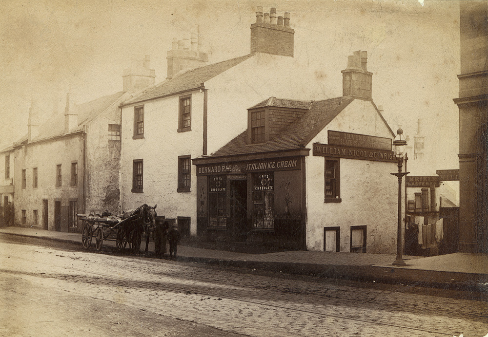
Bernard Rae’s Ice Cream parlour on Pollokshaws Road, also visible in Washington’s photograph, c. 1890
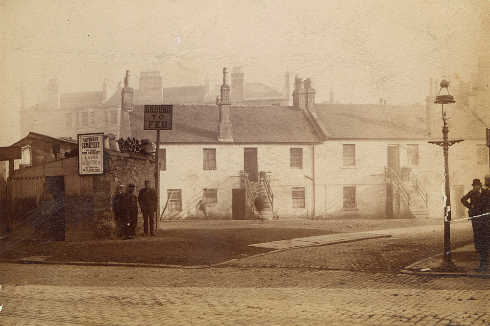
Weavers’ cottages, although these ones were nearer Allison Street
Opposite Bernard Rae’s are some of the older tenement buildings that still exist, the lower three storey building now houses Corals Bookmakers.
Nithsdale Road
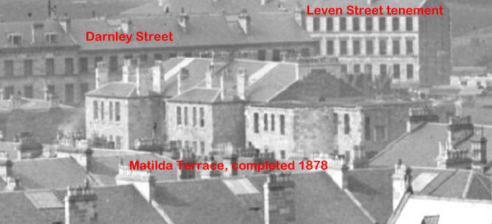
The south side of Nithsdale Road was built as Matilda Terrace by William Howie & Son, and completed in 1878. It is half way through construction in the photograph, so perhaps it was taken in 1877. The buildings nearer Pollokshaws Road have no roof. The tenement on the north side was completed in 1877.
The terrace on Darnley Street is incomplete, allowing us to see the tenement on Leven Street through the gap. The Darnley Street tenement was later extended.
Shields Road

In the far distance, at the top left of the photograph, we can see the buildings of Shields Road, and some of the earliest Pollokshields villas atop the hill, mostly now lost. The jagged roof line and rear extensions identify the houses between Leslie Street and Albert Drive.

Shields Road Houses, Pollokshields Church to the left
To the right of the houses, on the corner of Albert Drive, is the newly constructed church hall of Pollokshields Church of Scotland, complete with a small bell-cote to the side. The hall opened in October 1875. The foundation stone of the church itself was laid in May 1877, and the church opened in March 1878. The absence of the church in the photograph fits with a date of 1876 or 77. The remains of where the bell-cote stood are still visible squashed between hall and church. The tenement on the corner of Albert Drive and Herriot Street, directly in front of the church, can be seen under construction.
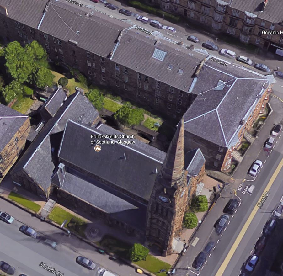
Pollokshields Parish Church, with hall to the left, & Herriot St tenement (Google Maps)
In the lower part of the photo one can see the roofs of 1-10 Moray Place, and behind it the buildings of Nithsdale Road, including the location of (until recently) GS Kitchen Pharmacy.
Leave a Reply